Sent: Thursday, April 24, 2008 4:25 AM
Subject: Muslim Separtists
In this area kidnapped resort tourists several years ago. So this resort has
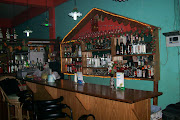
2 platoons of soldiers that also work in the resort. Charity, a 19yo looker
and bartender, is one of our guards. Wed was total relaxation time on the
mooring. Best snorkling ever. The resort also had a large French wedding
party with several memorable women. High cliffs back the resort and a cross
is on one peak. While snorkling a praying angel was found in the depths
facing the cross. Today the 24th we left this special place and headed for
open water.19 kts`of wind on the nose no fun. Now at Cabulaun Island 11 23n
120 05e. A great natural anchorage. Several fisherman on shore supply
abundant flies but we are in a perfect semicircle of beach, palmtree, and
mountain.
Sent: Thursday, April 24, 2008 8:16 AM
Subject: Cabulauan
The depth sounder worked and we got into the lee and anchored in 20ft and
sand. On the beach ahead were 16 Vulcan war birds but different. These all
had curved outriggers that bent upwards from the one that went into the
water. Sort of a W on top of a M. Before sunset every one left the shore and
passed us close aboard. Each had exactly 6 crew. Now they are in sight off
shore with bright halogen lights--squid catchers. After sunset we were
cooking on the grill when out of the dark we were boarded by 3 men. Boarded!
They asked if we wanted to buy dried squid. Then added they did not have
enough money to buy rice. So I bought some. I have always said only 2 things
smell like fish and one of them is fish. Now I know there are 3 and one is
dried squid. Still a magic encounter. These men as poor as anyone on this
earth spoke English. They came from the mountain and invited us to visit
tomorrow.
Saturday, April 26, 2008

Tuesday, April 22, 2008
Captain Scott's Log ~ Tuesday, April 22, 2008
Subject: Club Noah Resort
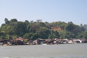
On Apulit Island. 10 57n 119 36.6e Last night in the mangroves and tonight
on a mooring jn the lee of high cliffs, sand beaches, and a resort built on
stilts over the water alla the south seas. We passes Paley Island this
morning which the guide book said had white beaches `and waterfalls. Finding
neither we went on to Tay Tay the old capital of this island. Old Spanish
fort overlooks this forgotton village. Lunch ashore and bought some fresh
veges and fruit. Then on to Apulit for the night. The resort was a suprise
and we were approached by a patrol who told us the resort was full. We said
we would pay for a mooring and dinner---and, they said they will pick us up
at 8 for dinner.As an aside, all the native boats have outriggers of
bamboo---even large boats. The bigger ones have high curved beams to the
outriggers and so look like a M when approaching. Neat but also sinister and
we call them Vulcan Birds of Prey
On Apulit Island. 10 57n 119 36.6e Last night in the mangroves and tonight
on a mooring jn the lee of high cliffs, sand beaches, and a resort built on
stilts over the water alla the south seas. We passes Paley Island this
morning which the guide book said had white beaches `and waterfalls. Finding
neither we went on to Tay Tay the old capital of this island. Old Spanish
fort overlooks this forgotton village. Lunch ashore and bought some fresh
veges and fruit. Then on to Apulit for the night. The resort was a suprise
and we were approached by a patrol who told us the resort was full. We said
we would pay for a mooring and dinner---and, they said they will pick us up
at 8 for dinner.As an aside, all the native boats have outriggers of
bamboo---even large boats. The bigger ones have high curved beams to the
outriggers and so look like a M when approaching. Neat but also sinister and
we call them Vulcan Birds of Prey
Monday, April 21, 2008
Captain Scott ~ Monday, April 21, 2008
Subject: Roxas and further north
The trip north from Puerto Princessa was easy in the beginning. Offshore the
depths went from 4000 to 16 feet frequently which made for some spectacular
tidal rips (like the hump off Marathon). A squall gave us 18kts on the nose.
Green Island Bay has numerous islands and shoals and we soon found our
charts and chart plotter suspect. Our GPS chart plotter showed us sailing
across an island that does not seem to exist. Roxas was found and we
anchored in 8.5ft well off the beach. Rosemary was delivered to her friend.
Jeff and Mark had a drink ashore and as foreigners became the town
attraction. The next morning it was apparent we had several problems. The
depth sounder did not work all the time, we were going east into the rising
sun and blinded, and the chart plotter was unreliable. So we chose a longer
safer route. Still I throttled back and slowly picked our way. In what
should have been 65ft of water, noted a water color change and pulled the
throttle to neutral. The depth sounder awoke and read 14ft. I reversed and
we hit and grounded at 3 kts. The sounder now reads 7.1 ft. We draw 7.5. So
after getting off we proceed very cautiously and found much wrong with the
charts. And the water is murky. Dumaran Island passage is narrow, reef
strewn, and charted by Capt Cook. We followed his route witch was fine
except for miles of unmarked fish farms. By early afternoon we were
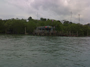
exhausted by the slow pace and put into a nearly landlocked bay for the
night. Without depth sounder we used the Fortress anchor and line as a lead
line to find bottom. Now anchored in remote mangroves watching the natives
slash and burn the hillsides.
The trip north from Puerto Princessa was easy in the beginning. Offshore the
depths went from 4000 to 16 feet frequently which made for some spectacular
tidal rips (like the hump off Marathon). A squall gave us 18kts on the nose.
Green Island Bay has numerous islands and shoals and we soon found our
charts and chart plotter suspect. Our GPS chart plotter showed us sailing
across an island that does not seem to exist. Roxas was found and we
anchored in 8.5ft well off the beach. Rosemary was delivered to her friend.
Jeff and Mark had a drink ashore and as foreigners became the town
attraction. The next morning it was apparent we had several problems. The
depth sounder did not work all the time, we were going east into the rising
sun and blinded, and the chart plotter was unreliable. So we chose a longer
safer route. Still I throttled back and slowly picked our way. In what
should have been 65ft of water, noted a water color change and pulled the
throttle to neutral. The depth sounder awoke and read 14ft. I reversed and
we hit and grounded at 3 kts. The sounder now reads 7.1 ft. We draw 7.5. So
after getting off we proceed very cautiously and found much wrong with the
charts. And the water is murky. Dumaran Island passage is narrow, reef
strewn, and charted by Capt Cook. We followed his route witch was fine
except for miles of unmarked fish farms. By early afternoon we were
exhausted by the slow pace and put into a nearly landlocked bay for the
night. Without depth sounder we used the Fortress anchor and line as a lead
line to find bottom. Now anchored in remote mangroves watching the natives
slash and burn the hillsides.
Captain Scott ~ Saturday, April 19, 2008
Subject: Puerto Princessa
We are anchored off a YC in a pretty bay with high mountains to the west.
9 45N 118 47E. There are only 3 other cruising boats here. All friendly and
helpful. We have found fuel, good provisions, a good restaurant and several
drivers. Most transport is by Tuk tuk (3 wheel motor bikes). Yesterday we
went across the island to a World Heritage Site--a park which features the
world’s longest navigatable underground river. We were told it was a 2 hour
drive which it was. Had it been driven safely (which it wasn't) it would have
been 4 hours. And if one of us drove it would have been 6. A white knuckle
hair raising drive on one lane dirt roads across the high central mountains.
Passing brightly colored buses that had seats for 30 and contained 90
passengers and their chickens. 30 in seats-30 on their laps-and 30 on the
roof. 3rd world driving is the real danger in sailing around the world—
forget pirates and typhoons. We called our driver "suicide Willy"
which seemed to make him drive faster. In the park we stopped for a
permit---then later stopped to pay for the permit---then later stopped in a
small town to pay for a boat. We were told the boats were all filled and to
come back in 4 hours. So we ate at a roadside spot that featured 2 pots. One
was a greasy wild boar stew and the other was greasy cooked vegetables.
Bill has relapsed and does not get far from the head. We finally caught our
boat--a canoe with outriggers that took us around to a beach. From there we
got into our 4th line for the one hour trip through the underground river.
Bats and Stalagtites I expected but my surprise was swallows. They flew
through the cave in large numbers obviously navigating the same as the
bats--by sound. Today we sail north to Roxas. We will take Rosemary. She’s a
British lady, who sailed here with her husband, then he died, and she’s here
alone on their boat.
We are anchored off a YC in a pretty bay with high mountains to the west.
9 45N 118 47E. There are only 3 other cruising boats here. All friendly and
helpful. We have found fuel, good provisions, a good restaurant and several
drivers. Most transport is by Tuk tuk (3 wheel motor bikes). Yesterday we
went across the island to a World Heritage Site--a park which features the
world’s longest navigatable underground river. We were told it was a 2 hour
drive which it was. Had it been driven safely (which it wasn't) it would have
been 4 hours. And if one of us drove it would have been 6. A white knuckle
hair raising drive on one lane dirt roads across the high central mountains.
Passing brightly colored buses that had seats for 30 and contained 90
passengers and their chickens. 30 in seats-30 on their laps-and 30 on the
roof. 3rd world driving is the real danger in sailing around the world—
forget pirates and typhoons. We called our driver "suicide Willy"
which seemed to make him drive faster. In the park we stopped for a
permit---then later stopped to pay for the permit---then later stopped in a
small town to pay for a boat. We were told the boats were all filled and to
come back in 4 hours. So we ate at a roadside spot that featured 2 pots. One
was a greasy wild boar stew and the other was greasy cooked vegetables.
Bill has relapsed and does not get far from the head. We finally caught our
boat--a canoe with outriggers that took us around to a beach. From there we
got into our 4th line for the one hour trip through the underground river.
Bats and Stalagtites I expected but my surprise was swallows. They flew
through the cave in large numbers obviously navigating the same as the
bats--by sound. Today we sail north to Roxas. We will take Rosemary. She’s a
British lady, who sailed here with her husband, then he died, and she’s here
alone on their boat.
Thursday, April 17, 2008
Captain Scott ~ Thursday, April 17th
Subject: Sulu Sea
8 42N 118 04E midnight. Under power going NE up the eastern side of
Palawan. 10 kts of wind on the nose witch is no suprise as we are in the NE
monsoon.. Last night we stopped short of the Balabac Strait and pulled into
cozy cove. Balabec Straits are the 3rd most noted area for pirates after the
coast of Yemen and the Malaca Straits. So I chickened out and went through
this morning in daylight. Pretty night. Lightning ashore lites up some tall
mountains. Passed an entire large palm tree with many of its fronds sticking
out of the water. Southern Cross still high in the sky. ETA for Puerto
Princessa is 1100 today (18th). We will clear in there and spend a few days
exploring
8 42N 118 04E midnight. Under power going NE up the eastern side of
Palawan. 10 kts of wind on the nose witch is no suprise as we are in the NE
monsoon.. Last night we stopped short of the Balabac Strait and pulled into
cozy cove. Balabec Straits are the 3rd most noted area for pirates after the
coast of Yemen and the Malaca Straits. So I chickened out and went through
this morning in daylight. Pretty night. Lightning ashore lites up some tall
mountains. Passed an entire large palm tree with many of its fronds sticking
out of the water. Southern Cross still high in the sky. ETA for Puerto
Princessa is 1100 today (18th). We will clear in there and spend a few days
exploring
Captain Scott's Log ~ Sunday, April 13th 2008
Subject: P Dream Kinabalu
The last of the NE monsoon kicked in again and we sailed hard on the wind
through giant oil platforms. Truly amazing structures over ten stories tall
dedicated to deep drilling. We sailed very close by rail down with the stars
and stripes flying to waves and cheers from the rig workers. Sutera Marina
is in Kota Kinabalu, Sabah--now part of Malysia--on the north Borneo coast.
We entered slowly in the pitch black Just before dawn using radar and GPS
chart plotter. Here is an upscale resort with 2 hotels, 3 pools, 9 restaurants
and 1 golf course. The harbor came alive at first light with a constant
stream of small ferries taking hotel guests out to the marine park. And a
large fishing tournament ends today. I couldn’t get a room in either hotel as
both were/are filled. Bill and Donna have my cabin forward. This is such a
great find that we are staying a few days. Kinabalu National Park is a World
Heritage Site. It's 14000ft mt peak is the highest non volcanic mt this side
of the Himalayas. Sabah has its own flag witch is flown from all yachts. My
newest country courtsey flag, the first of 08, and number 116. China will be
the next one. Dinner in town last night where the menu was hundreds of
aquariums filled with every variety of fish, crustian, etc we selected a
large grouper that more than fed the 5 of us. Our waiter about lost his hand
getting it out of the tank.
The last of the NE monsoon kicked in again and we sailed hard on the wind
through giant oil platforms. Truly amazing structures over ten stories tall
dedicated to deep drilling. We sailed very close by rail down with the stars
and stripes flying to waves and cheers from the rig workers. Sutera Marina
is in Kota Kinabalu, Sabah--now part of Malysia--on the north Borneo coast.
We entered slowly in the pitch black Just before dawn using radar and GPS
chart plotter. Here is an upscale resort with 2 hotels, 3 pools, 9 restaurants
and 1 golf course. The harbor came alive at first light with a constant
stream of small ferries taking hotel guests out to the marine park. And a
large fishing tournament ends today. I couldn’t get a room in either hotel as
both were/are filled. Bill and Donna have my cabin forward. This is such a
great find that we are staying a few days. Kinabalu National Park is a World
Heritage Site. It's 14000ft mt peak is the highest non volcanic mt this side
of the Himalayas. Sabah has its own flag witch is flown from all yachts. My
newest country courtsey flag, the first of 08, and number 116. China will be
the next one. Dinner in town last night where the menu was hundreds of
aquariums filled with every variety of fish, crustian, etc we selected a
large grouper that more than fed the 5 of us. Our waiter about lost his hand
getting it out of the tank.
Captain Scott & Jeff's Log ~Friday, April 11th, 2008
Friday, April 11, 2008 South China Sea 4 42.840N 112 36.229E
Jeff's Log
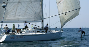
We are finally under sail! Yesterday, a squall came up and gave us 25 knots of wind. It began about a half hour into my watch. We had been motor sailing, and had to roll up half of the jib, and reef the main. The autopilot still does not work on starboard tack when the wind is up, so I had to drive. I am not complaining, I thoroughly enjoyed every minute of it. It blew hard for about an hour and a half, and then moderated. Donna took over the helm, and after a short time, the wind had gotten fairly light again, so we switched back to autopilot and shook out the sails again. The night became clear and beautiful and we were able to motor sail most of the time.
Today was a bright sunny day with moderate breezes. Just before sunset, we got enough wind to shut the engine off and sail. Mark did some chicken on the Barbie. And we had a nice dinner without the engine running for the first time since leaving Singapore. Tonight my watch starts at 4AM, so after writing this I will turn in for hopefully a nice, engine free sleep.
One thing that we all got a chuckle from happened when Donna got off watch. She went to lay down for a nap and opened up the hatches in the forward cabin over the bed. There was left over waves from the squall, and we caught one and it washed into the hatch, right onto Donna. She came out rather embarrassed and looked like a drowned rat. I am sure that we’ll be teasing her about that for the rest of the trip.
We are now sailing by some huge gas wells. Each one looks like a small city with the amount of lighting that is present. According to the chart, they pipe the gas to shore. Shore is about 80 miles away.Pipe Dream continues to behave herself and is working very well. I do have a nasty job to do tomorrow. I have to take the aft head apart and replace pump seals.Sometimes being the engineer on a yacht is a crappy job!
~~~~~~~~~~~~~~~~~~~~~~~~~~~~~~~~~~~~~~~~~~~~~~~~~~~~~~~~~~
Captain Scott's LogSubject: P Dream Sarawak
FRI Now 4 days out and all under engine. We are 75nm off the Coast of
Sarawak and under easy sail at last, flat water with some current behind--a
dream sail. We are passing through the Central Luconia Gas Field with some
major platforms nearby. Our grill is lit for barbeque dinner. The chart says
beware of fire hazard and loss of bouyancy with pipe line rupture. Yesterday
we sailed for the first time when hit with a squall. 25kts of wind and we
were off with a part rolled up jib and a reef. Donna was slow to close her
cabin and rewarded with a bucket of water through the hatch. You know what a
drowned rat looks like--right! Life is easy if you like suntan, reading,
sleeping in, the gurgle of water slipping by and the next port 36 hours away
Jeff's Log
We are finally under sail! Yesterday, a squall came up and gave us 25 knots of wind. It began about a half hour into my watch. We had been motor sailing, and had to roll up half of the jib, and reef the main. The autopilot still does not work on starboard tack when the wind is up, so I had to drive. I am not complaining, I thoroughly enjoyed every minute of it. It blew hard for about an hour and a half, and then moderated. Donna took over the helm, and after a short time, the wind had gotten fairly light again, so we switched back to autopilot and shook out the sails again. The night became clear and beautiful and we were able to motor sail most of the time.
Today was a bright sunny day with moderate breezes. Just before sunset, we got enough wind to shut the engine off and sail. Mark did some chicken on the Barbie. And we had a nice dinner without the engine running for the first time since leaving Singapore. Tonight my watch starts at 4AM, so after writing this I will turn in for hopefully a nice, engine free sleep.
One thing that we all got a chuckle from happened when Donna got off watch. She went to lay down for a nap and opened up the hatches in the forward cabin over the bed. There was left over waves from the squall, and we caught one and it washed into the hatch, right onto Donna. She came out rather embarrassed and looked like a drowned rat. I am sure that we’ll be teasing her about that for the rest of the trip.
We are now sailing by some huge gas wells. Each one looks like a small city with the amount of lighting that is present. According to the chart, they pipe the gas to shore. Shore is about 80 miles away.Pipe Dream continues to behave herself and is working very well. I do have a nasty job to do tomorrow. I have to take the aft head apart and replace pump seals.Sometimes being the engineer on a yacht is a crappy job!
~~~~~~~~~~~~~~~~~~~~~~~~~~~~~~~~~~~~~~~~~~~~~~~~~~~~~~~~~~
Captain Scott's LogSubject: P Dream Sarawak
FRI Now 4 days out and all under engine. We are 75nm off the Coast of
Sarawak and under easy sail at last, flat water with some current behind--a
dream sail. We are passing through the Central Luconia Gas Field with some
major platforms nearby. Our grill is lit for barbeque dinner. The chart says
beware of fire hazard and loss of bouyancy with pipe line rupture. Yesterday
we sailed for the first time when hit with a squall. 25kts of wind and we
were off with a part rolled up jib and a reef. Donna was slow to close her
cabin and rewarded with a bucket of water through the hatch. You know what a
drowned rat looks like--right! Life is easy if you like suntan, reading,
sleeping in, the gurgle of water slipping by and the next port 36 hours away
Subscribe to:
Posts (Atom)












.jpg)
.jpg)
.JPG)
.jpg)
.jpg)
+(2).jpg)
.jpg)
.jpg)
.jpg)
.jpg)
.jpg)
.jpg)
.jpg)
.jpg)
.JPG)
.jpg)
.JPG)